The second stop on our trip to Sutton was Appalachian Timber Services. The facility manufactures treated wood products. These include railroad ties, bridge timbers, and mine supports. The milled lumber arrives via truck and undergoes final cuts and treatment before being shipped to customers. One of the largest customers for ATS is MTA New York City Transit. The subway system in New York City runs on railroad ties built in Sutton, WV. Heat for the creosote process is provided by burning wood product that would be waste in the past creating an eco friendly facility. They also sell sawdust to fuel pellet manufacturers when excess is produced.
Sunday, September 9, 2012
Saturday, September 8, 2012
Fall Trip to Sutton, WV - Weyerhaeuser
 |
| Timber Yard at Weyerhaeuser OSB Plant |
The Weyerhaeuser OSB plant produces oriented strand board that features strands of wood that are arranged in cross layers and pressed to form sheets. The result is a product similar to plywood with a different appearance. OSB is mostly used as a sheathing material in building construction. The facility can process 110,000 tons of timber in a six week span. Little waste is left from the process as the plant uses the bark and other unusable material to fire the furnace. After the debarking and shredding process, the particles are dried to a moisture level of 5% - 8% and sorted before being laid into layers on a screen that can be up to seven or eight inches thick depending on the product being produced. A press then compresses the mat using 850 PSI on the board. 108 boards are fed into the press for each load and the procedure lasts roughly five minutes from loading of the press until the product leaves the press. The product is then cut into 4 x 8 sheets and readied for shipping.
 | ||
| Timber Yard |

 | ||
| Close-up of shredder wheel |
 |
| Feed piping for shredded timber |
 |
| Mat ready for press |
 |
| Shipping bundler |
The plant was built in 1996 and currently employs 135 workers. The plant warehouses the products before shipping via truck or rail. There are six truck bays and an eight rail car loading dock. The current production level requires 60 trucks per day for freight. Weyerhaeuser has four OSB plants in the United States.
Tuesday, August 28, 2012
Upcoming Follow-up Trip
In a little over a week, the Forest and Rail group will be heading to Flatwoods, West Virginia for a quick tour of two more wood product plants. The first stop will be at Weyerhaeuser in Sutton to examine the production of oriented strand board, OSB, a product used widely in construction as a sheathing in building. The board use wood chips that are bonded together using a resin and heat to create a product the exhibits many qualities of solid wood.
The second stop will be at Appalachian Timber Services in Sutton. They produce products such as railroad ties and bridge timbers that are resistant to rot through the use of chemical treating or species that are naturally resistant to environmental factors. The fact that wood ties are still used today in railroads demonstrates the longevity and attributes that make wood a viable material even with other materials available.
The second stop will be at Appalachian Timber Services in Sutton. They produce products such as railroad ties and bridge timbers that are resistant to rot through the use of chemical treating or species that are naturally resistant to environmental factors. The fact that wood ties are still used today in railroads demonstrates the longevity and attributes that make wood a viable material even with other materials available.
Sunday, July 29, 2012
Water Quality Overview

Look at the water test results.
- Are there any trends in the data?
- Other than the dissolved oxygen, did the remaining tests show that the river was changing as we moved downstream? Why?
Friday, July 20, 2012
C&O Museum
 |
| 614 4-8-4 Steam Locomotive |
 |
| Tom Hefner explains RR traffic |
 |
| Caboose on Little C&O |
 | |
| Controls on 614 |
Think about the following:
- Compare 614 locomotive to the Shay locomotives at Cass. What are some differences? Why are they different?
- Why would air conditioning in 1932 be considered a luxury? Do some research on air conditioning and discover when it reached consumers as a common convenience (this will surprise you).
Greenbrier Water Test #3
First stop today was right outside of Lewisburg near the beginning of the Greenbrier Trail. The group avoided rain by testing the water under interstate bridge near Cat's Rock swimming area. Rex Dillinger suggested the area from previous visits to the river.
Rain had been falling since the previous night which would influence water quality since runoff and particulate would be agitated. After crunching the data and analyzing the quality overall, the water at this point rates medium at 57.67. Weather dropped the number ten points from Durbin.
Some questions to think after three test sites.
1. How would calibration of equipment test to test affect outcomes?
2. Why does water quality change as you move downstream?
3. The Greenbrier empties into the New River. What do you think the water quality will be in the New?

Durbin Rocket and Water Quality

 |
| Durbin Rocket |
The second part of the stop involved researching and riding the Durbin Rocket. The Durbin Rocket is a Climax Locomotive built in 1910 for the Moore-Keppel Lumber Company and weighs 55 tons. The excursion lasted a couple hours and covered rail ways along the Greenbrier River. The locomotive remains coal-powered and operates June through October.
 | |
| William Strait and the Durbin Rocket |
Think about the following:
- How would testing the water quality downstream of a data point affect the outcome?
- Why would the lower weight of the Climax create a faster engine compared to a Shay?
 |
| Piston on Climax Locomotive |
Thursday, July 19, 2012
Gaudineer Knob


Tuesday, July 17, 2012
Beverly Wood Manufacturing: Colonial Millwork & Armstrong
 | |
| Knives for moldings |
CNC Machine for cutting shapes from panels

Our next stop was was Armstrong Products. The division in Beverly is the hardwood flooring for Armstrong. The products manufactured are pre-finished floors that are ready to shipment to retailers for ultimate consumption by consumers. The plant has the largest kiln operation east of the Mississippi River and operates 38 kilns for drying wood. The kilns are fueled by sawdust from the plant, but even with the kiln sawdust burning, Armstrong removes four full truck loads of sawdust each day from the facility. They focus on the traditional flooring lines the utilize oak, maple, and ash species. Unfortunately, photography and video was not allowed in the plant which is by far the largest wood manufacturer we visited while in Randolph County.
Think about the following:
- What are the benefits of focusing on only a few species of wood for Armstrong?
- Why would Colonial Millwork store so many knife profiles? How would this affect future mill work?
Hamer Fuel Pellet Visit
The first stop on Monday for the Forest and Rail was Hamer Fuel Pellet in Elkins. WV. Jim Dearing provided the group with a tour of the facility that manufactures fuel pellets for heating. Hamer uses sawdust, a waste product from milling lumber, to fully utilize the complete resource of the tree.
 The process starts with truck delivery of sawdust from a mill. The dust is sorted according tree species before being loaded into the dryer. The 110,000 pound drum is heated by a 55 million BTU furnace that maintains a drying temperature of 1800 degrees Fahrenheit. Each load of 30 tons dries to a weight of 15 tons before entering the extrusion process.
The dry sawdust has vegetable oil infused before entering the extrusion machine. The machine uses a system of rollers and a die to press the dust into cylinder shapes before being cut to roughly 1/2 inch lengths that are 1/4 inch diameter. The pellets are used in a pellet stove to provide efficient heating with minimal waste and ash.
 Questions to think about:
- Research trobology. How does pellet fuel meet the concept?
- What are some benefits of using pellet fuel?
- Why would wood product manufacturers benefit from pellet fuel?
Monday, July 16, 2012
Presentation on Randolph County with Whetshell
Robert Whetshell spoke with the Forest and Rail Project on Monday evening on how Randolph County and Elkins have changed over time due to the influence of railroads, timber, manufacturing, and other economic factors.
When most people think of the mountainous regions in West Virginia, they think that the trees were mostly untouched until settlers arrived in the late 1700's. In reality, the Native Americans removed trees to before then to access larger flat regions. The settlers of Randolph County then continued the practice of girdling, used by Native Americans, to create mountain homesteads and cutting to build homes.
At one time, Randolph County was estimated to have close to 400,000 acres of virgin forest before the 1880's. When the harvesting of timber started in earnest, the axe and cross-cut saw where the modern tools for falling trees. When the tree was milled, the Pit or Whip Saw was an arduous process that required two men to complete the milling of lumber.
The 1880's brought water-powered mills that known as a Sash Sawmill that limited the use of man power, but the process was slow only able to cut 500 feet per day. Animals, horses or mules, were used to drag lumber out of the forest to mills or as the power for hauling along primitive rail systems. Other options were Splash Dams, Log Slides, Floating Log Drives, but the most influential was steam power. Not only for transport on railroads, but as a machine to mill lumber using circular saws and band saws. Randolph County had close to 30 band saws operating during the rush of timber operations from the 1880's to the 1920's.
 Aerial cables were used to remove logs from the forest to ready for transport to mills. The geared locomotive was the answer due to the ability to navigate mountainous terrain. The Shay, Climax, and Heisler locomotives used gears for moving up slopes that would stop rod locomotives. West Virginia Central & Pittsburgh RR was started by H.G. Davis and S.B. Elkins, influential business and political figures from the era, utilized geared locomotives. The railroads helped establish rapid growth of boom towns along the rail lines. As the timber was harvested and the resource gone, the boom towns lost significant numbers in population and the economies of the towns stagnated and declined.
Some quick facts about West Virginia's Forest:
Think about the following:
Shay Image from http://i.images.cdn.fotopedia.com/flickr-3641669696-hd/US_National_Parks/California/Yosemite_National_Park/Yosemite_Mountain_Sugar_Pine_Railroad/Locomotive_10_at_Sugar_Pine_Railroad_-_Yosemite_California.jpg used under Creative Commons.
When most people think of the mountainous regions in West Virginia, they think that the trees were mostly untouched until settlers arrived in the late 1700's. In reality, the Native Americans removed trees to before then to access larger flat regions. The settlers of Randolph County then continued the practice of girdling, used by Native Americans, to create mountain homesteads and cutting to build homes.
At one time, Randolph County was estimated to have close to 400,000 acres of virgin forest before the 1880's. When the harvesting of timber started in earnest, the axe and cross-cut saw where the modern tools for falling trees. When the tree was milled, the Pit or Whip Saw was an arduous process that required two men to complete the milling of lumber.
The 1880's brought water-powered mills that known as a Sash Sawmill that limited the use of man power, but the process was slow only able to cut 500 feet per day. Animals, horses or mules, were used to drag lumber out of the forest to mills or as the power for hauling along primitive rail systems. Other options were Splash Dams, Log Slides, Floating Log Drives, but the most influential was steam power. Not only for transport on railroads, but as a machine to mill lumber using circular saws and band saws. Randolph County had close to 30 band saws operating during the rush of timber operations from the 1880's to the 1920's.
 Aerial cables were used to remove logs from the forest to ready for transport to mills. The geared locomotive was the answer due to the ability to navigate mountainous terrain. The Shay, Climax, and Heisler locomotives used gears for moving up slopes that would stop rod locomotives. West Virginia Central & Pittsburgh RR was started by H.G. Davis and S.B. Elkins, influential business and political figures from the era, utilized geared locomotives. The railroads helped establish rapid growth of boom towns along the rail lines. As the timber was harvested and the resource gone, the boom towns lost significant numbers in population and the economies of the towns stagnated and declined.
Some quick facts about West Virginia's Forest:
- 30 billion board feet were harvested between 1870 and 1920.
- 10 million acres of virgin forest were harvested
- Only 140 acres were spared as a result of survey error
- Hemlock trees will be lost due to the wooly adelgid infestation
- Erosion occurs quickly after deforestation
- Siltation from erosion in streams causes flooding issues
Think about the following:
- How have things changed in timber operations? Do different regulations apply today?
- Why is protecting watersheds from excess runoff important? What evidence do we see to protect water ways?
- How were the National Forests established in West Virginia?
- How did the Civilian Conservation Corp contribute to forestry?
- What can be done to maintain and improve the forests?
Whetshell, Robert. (2012) Forestry in Randolph County. Elkins, WV. July 16, 2012
Sunday, July 15, 2012
Cathedral Forest - Virgin Hemlock Forest

What makes the the forest unique beyond the stipulations for remaining uncut is the appearance of the forest from under the canopy. When in the forest, the first thing noticed will be the lack of a thick undergrowth on the floor. The predominantly hemlock trees create an atmosphere that is considerably different than forest at lower altitudes or forest that were harvested for the timber content. Follow the link below to see a 360 degree view from the forest.
Cathedral Forest 360 from 7/15/2011
Questions to think about:

- Why do you think the forest floor appears so much different than a harvested forest?
- How do new trees compete with the old growth trees?
- The bark of hemlocks was used to tan leather in the past. What would this tell you about how the tree affects the pH level of the soil?
The group measured a hemlock tree while in the forest. We also computed pH for the soil. The data below shows the outcome from that field experience.


Sunday, July 1, 2012
Water Quality Sample for Four Pole Creek

On June 24, I went to Ritter Park to collect a water sample from the creek and to take a few pictures. The results of the water quality testing are shown in the table below.

To test water quality, follow the procedures listed here from Investigating Environmental Science.
 1. Collect water sample.
2. Using Vernier Labquest, test temperature, pH, dissolved oxygen, conductivity, turbidity, using the appropriate sensors or probes.
3. You will also need DO tables to determine dissolved oxygen for the conditions on the day of the test.
4. Once the data is collected, it will be entered into the spreadsheet. You will need to compare the data to the chart to determine Q values for each parameter.
5. Check outcomes on spreadsheet to make sure no errors are present.
Think about the following:
- How does the water quality vary with changes in temperature?
- Why would water flow rate change quality?
- Would changing the collection point alter the results? Why or why not?

Friday, June 15, 2012
Timber Transport in the 21st Century
Last Thursday on I-77 near Chesapeake, I passed a truck carrying a load of logs. The development of the modern truck for transport of large, cumbersome items changed the face of mass transport for the United States. Trucks are primarily utilized for commodity goods for end user consumption, but are also used for movement of raw materials such as coal or wood. Intricate supply systems are now in place for rapid fulfillment of orders as needed to lower overhead costs for companies.
According to a 2007 study from the University of Memphis, 4%, in tons, of freight moved by truck was a wood product. While this number is low, the flexibility of trucks creates opportunities that are much more difficult via railroad. The numbers change when examining revenues for truck versus rail transport. 27% of all revenue for railroads is generated by wood, paper, and associated products. That translates to $2.70 out of every $10 is directly impacted by timber or wood products.
Looking at this data, how does revenue show the impact of timber on railroads? Why would this information be relevant when maintaining rail lines or building new ones?

Report retrieved from: http://www.memphis.edu/ifti/pdfs/cifts_freight_baseline.pdf
According to a 2007 study from the University of Memphis, 4%, in tons, of freight moved by truck was a wood product. While this number is low, the flexibility of trucks creates opportunities that are much more difficult via railroad. The numbers change when examining revenues for truck versus rail transport. 27% of all revenue for railroads is generated by wood, paper, and associated products. That translates to $2.70 out of every $10 is directly impacted by timber or wood products.
Looking at this data, how does revenue show the impact of timber on railroads? Why would this information be relevant when maintaining rail lines or building new ones?
Report retrieved from: http://www.memphis.edu/ifti/pdfs/cifts_freight_baseline.pdf
Wednesday, June 6, 2012
Activities Updated
The links below lead to activities I have created for use with the Forest and Rail project for 6th grade. The lessons are challenge-based learning activities that encompass standards from each core content area. The students will be pushed to complete the activities within the allotted time frames reflecting authentic, real-world situations they will encounter in life. Working in small groups, the students will also be building 21st Century skills while manipulating the tools needed to succeed in the future.
Some questions that students will need to research and solve include:
Trees in the School Forest
Board Feet:Student Guide
Timber to Mill:Build a Railroad
Some questions that students will need to research and solve include:
- What types of trees grow in the BHMS forest?
- Why use GPS to mark tree locations? Why would that help others?
- How does tree height effect board feet? What other factors effect board feet output?
- How do I use a clinometer? Why use one?
- Why use Shay/Climax locomotives for transporting timber?
- How does slope limit train movement?
- How do I design a railroad to move timber to a sawmill? Why plot the route on the map?
- How does sharing my findings help others understand timber operations?
Trees in the School Forest
Board Feet:Student Guide
Timber to Mill:Build a Railroad
Thursday, April 26, 2012
Determining Tree Height & Board Feet
Finding usable tree height is accomplished using a clinometer. This device, which can be an app for Android and iOS devices, provides angles to deduce usable tree height for milling trees. After finding the percentage angles, subtract the base angle (negative value) from the angle where the usable tree height ends. Do not forget to change percentages to decimal form or the tree height will be incorrect. Multiply this result by 66 feet to determine the usable tree height. This measurement is needed to find the board feet available in the tree.

You also need to measure the circumference of the tree at chest level, roughly 4 1/2 feet from the ground. Convert this to diameter using the formula: diameter = circumference/3.14. Convert this from inches to feet by dividing by 12 and then find the radius by dividing by 2. The next step is finding cubic feet to estimate board feet.

Wednesday, April 25, 2012
Tree ID Updated
The tree identification page is now up and updated to reflect a sampling of trees from the Ritter Park outing last weekend. Formatting is causing some issues with the pictures and text, but that will be rectified over the next few weeks. I added the scientific names to the common names when available. Follow the tab link at the top of the page or this link.
Friday, April 20, 2012
Field Outing Tomorrow
Tomorrow is an all day outing for the Forest and Rail teachers are Ritter Park. We will be studying water quality using Vernier Science Probes, identifying trees by characteristics, using the Galaxy Tab to determine usable tree height, and calculating board feet of lumber available during milling. I look forward to gathering the data compiling information for the project.
By the end of the day tomorrow, I hope this blog will contain a comprehensive listing of trees in the park with pictures and identifiable traits for use by students during activities next year. I also need practice with the Vernier since my experience is limited to assisting others during training sessions. This field trip will be a good indication of how jam-packed the the trip will be later this summer.
Bring rain gear! If Steve and I are out anywhere, historically it a wet day at some point.
Saturday, April 14, 2012

Wednesday, April 11, 2012
Activities for Middle School
I spent the last couple of days at an infusing technology training that put gave me some ideas for implementing activities for the Forest and Rail Project. Nothing that is cutting edge technology by any means, but sound 21st century skills students implement for success in the future. These small group activities include:
- Students collect data on trees immediately around the school grounds. They will identify the trees using any means available and place into a spreadsheet that is shared for each class. Students will establish percentages for each type of tree in the area using data tools in Excel or Google Spreadsheet. The data will be compiled into one spreadsheet for the school.
- Using a method of establishing tree height, students establish which trees meet a minimum requirement and calculate the amount of board feet that could be harvested from the area. Using research information on timber prices, establish the revenue for the "forest" around the school.
- Research methods for replanting the trees that will be harvested and determine by produce a timeline for tree growth to mature level. Look at options for replanting different trees that may grow faster/slower that could increase revenue during future harvest.
- Determine the slope from the highest point of our harvest area to the lowest on the Ohio River. Would a Shay locomotive be needed for hauling timber to the river? Use Google Earth to examine topography and construct a railway to the sawmill location that will be determined later. The historic railroad tracks will also be examined.
- Each group will maintain a blog that contain artifacts and reflections on this project. This may become an individual blog.
Wednesday, April 4, 2012
WV Forestry Tree ID
Created by a West Virginia Division of Forestry worker and Tyler County FFA, this document helps identify common trees in the state. The trees are listed in alphabetical order in the document and include pictures of leaves, stems, and bark. Use the button in the upper right corner to open in a new window if a larger image is needed.
It is available for download at the following link: Tree Identification Presentation
Thursday, March 29, 2012
Backing Up Locomotives to Move Forward?
Some concepts to think about when studying the physics of railroads. These are still applicable today.
- Every time a train heads out,why does the locomotive back up before moving forward?
- Why did the Shay locomotive use a gearbox for timber operations in mountainous area?
- What key issues do locomotives when trying to negotiate steep grades?
Thursday, March 15, 2012
Railroad & Locomotive Talk with Mr. Withers
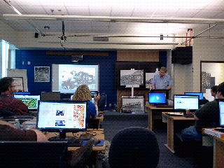
Mr. Withers discussing timber locomotives with the Forest & Rail Project participants. He showed the differentiation of how timber locomotives used a different suspension set and wheel size to enhance traction on steeper grade lines. His experiences with the railroad brought a unique a perspective to the lecture along with his passion for trains.
Thursday, March 8, 2012
The Journey Begins...
New project, new blog to share and reflect on how forests and railroads impact West Virginia. I am looking forward to this study this spring and the week-long investigation this summer. I need to brush up on my tree identifying skills ASAP as right now they are near zero! There is so much of this state that I know little about after living here all my life that the focus provided during this project is a welcome opportunity to gain knowledge and history.
For week two, Pat asked us to find some apps to share with the class for the Galaxy Tablet. Most apps that I have found for education are simple skill and drill items. I chose to focus on apps that can be used for productivity and creation. They are:
- 360 - This takes panoramas by stitching pics together from the onboard camera. Not near as full featured as Gigapan, but great on the run to show perspective. Free
- Box.net - Cloud-based storage that is not as slickly integrated on a PC as Dropbox, but offers 50GB of storage plus the ability to share folders and documents. Free
- NASA - The app ties in to NASA by delivering images, video, and ongoing missions and bringing to your tablet. It's not perfect by any means, but considering we fund NASA, we should use any resource available to access it. Free
- Antivirus Free - Android is an open operating system that needs antivirus protection due to recent threats. It works in the background scanning any download before installation. Free
- Tree Height Measurement - Measures tree height using Android device. Starts in German, but can be changed to English. Free
Subscribe to:
Posts (Atom)